Kasese Flood Analysis – 2024
Satellite-Based Assessment of Flood Patterns
Flooding is a recurring natural disaster in Uganda, particularly affecting districts like Kasese within the Rwenzori mountain ranges. Steep terrain, high rainfall, and dense river networks contribute to seasonal flooding that threatens lives, property, and infrastructure. This project assessed flood patterns in Kasese throughout 2024 using Sentinel-1 Synthetic Aperture Radar (SAR) imagery and the JRC Global Surface Water dataset. The goal: identify the month with the highest flood extent (excluding permanent water bodies) to support disaster management and urban planning.
Objective
Determine the month in 2024 when Kasese experienced the most extensive flooding (excluding permanent water bodies). By leveraging open-source satellite data and cloud-based geospatial tools, this analysis provides actionable insights for flood preparedness, risk mapping, and climate resilience strategies.
Data Sources and Tools
- Sentinel-1 SAR: C-band radar imagery (VV, ascending)
- JRC Global Surface Water Dataset: Occurrence layer to detect permanent water (≥90%)
- Region of Interest: Kasese District, Western Uganda
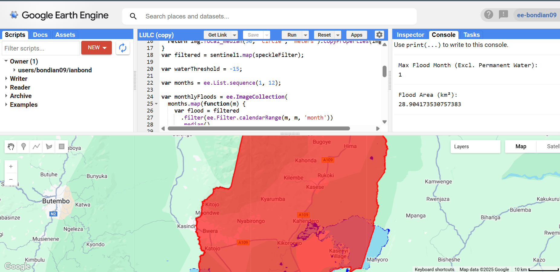
- Platform: Google Earth Engine (for data access and processing)
Methodology
The workflow was built in Google Earth Engine and included:
- Masking permanent water bodies using the JRC occurrence layer
- Filtering Sentinel-1 SAR images by date, polarization, and pass direction
- Reducing speckle noise with a smoothing filter
- Classifying flooded areas using a -15 dB threshold on radar backscatter
- Creating monthly composites and calculating flooded area for each month
- Ranking results to identify the peak flood period
Context: Flood Vulnerability in Kasese
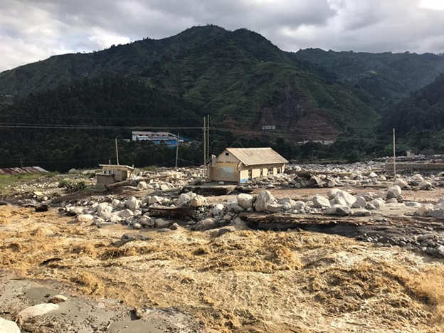
Kasese District is highly vulnerable to floods due to its proximity to the Rwenzori Mountains and the Nyamwamba River, which frequently overflows during heavy rains. The region has seen increasing damage to infrastructure—especially roads, schools, and bridges—with significant impacts on displaced families. Field observations and local reports confirm the scale of damage following early-year rainfall.
Results and Analysis
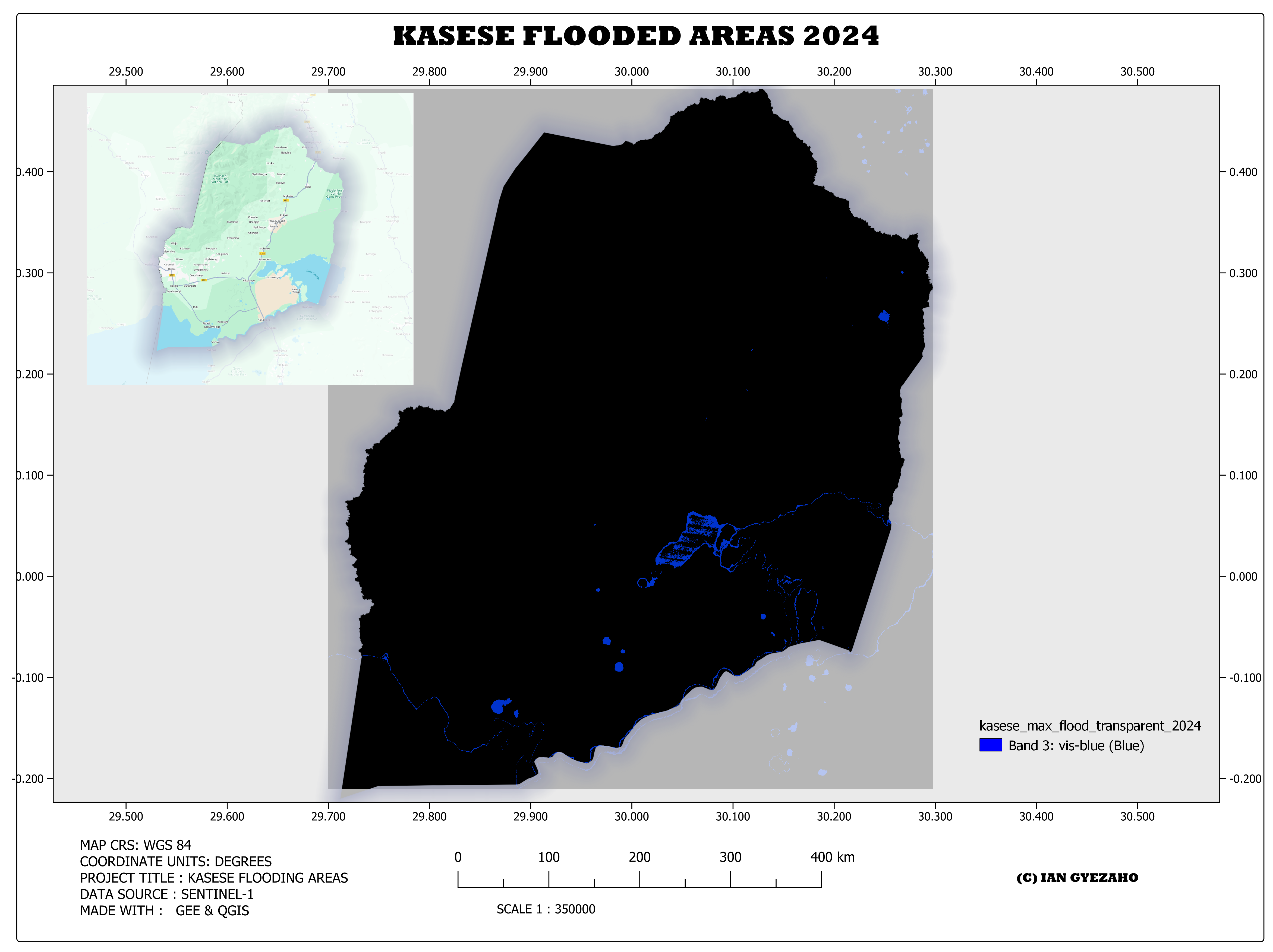
The monthly flood extent analysis revealed that January recorded the highest level of flooding in 2024. The estimated flooded area, excluding permanent water bodies, was approximately 28.90 square kilometers. This aligns with the region’s climatology, as January is typically part of the heavy rain cycle in western Uganda.
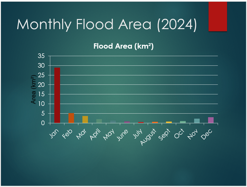
Floodwater was concentrated along riverbanks and low-lying urban areas, posing significant risks to communities in Kilembe, Nyamwamba, and Katwe-Kabatoro. Monthly composites provided a clearer temporal profile of flood risk evolution throughout the year.
Conclusion
- Peak Flood Month: January
- Flooded Area (excluding permanent water): 28.90 km²
- Key Tools: Sentinel-1 SAR, JRC GSW, Google Earth Engine
- Use Case: Disaster planning, infrastructure protection, early warning systems
This flood analysis offers valuable insights for disaster management, local government, and urban planning. By integrating radar satellite imagery and global water datasets, the study effectively isolated and quantified temporary flood events. The findings reinforce the importance of remote sensing tools and platforms like Google Earth Engine in delivering timely, data-driven support for flood resilience efforts.
Going forward, similar workflows can be expanded to analyze multi-year flood patterns, integrate rainfall data, and model flood recurrence intervals to support climate adaptation strategies in western Uganda and beyond.